
How to Find Rohnert Park Street Residents
The Rohnert Park street directory workflow moves from a physical location to the records keyed to it. Begin with the exact address and preserve the street spelling as printed. The county assessor uses address, assessment, or fee-parcel modes, while the public GIS layer lets each parcel polygon be opened and compared with nearby parcels. The APN is the bridge to deeds, permits, tax information, and a legal description.
That chain shows ownership and recorded activity more reliably than it shows occupancy. A deed names parties to an instrument. A permit names applicants and work details. A voter file, where lawfully available, captures registered voters only. Older directories and newspapers can identify a household at a date, but a missing name is not proof that no one lived there.
- Enter the address in the Sonoma County Assessor street-address mode and save every APN and situs result returned.
- Open the county parcel viewer, click the target polygon, and note the APN, sale fields, building data, exemptions, and assessor link.
- Use the APN or legal description to find a current recorded instrument, then trace the grantor and grantee names backward through the deed index.
- Search city permit history for address, APN, work, status, and inspection dates; request older files from the Building Division if needed.
- Use the approved voter channel, library holdings, newspapers, and historical directories only for the specific lawful question they can answer.
Rohnert Park Assessor by Address
The Sonoma County Assessor search offers three public modes: FEE PARCEL, ASSESSMENT, and STREET ADDRESS. The street form uses a search term, and county instructions say to omit Street, Road, Drive, Lane, and their abbreviations. A Quick Search accepts a fee parcel directly. There is no public owner-name mode. When the question starts with a person, find an address or APN first, then ask the Assessor about the specific parcel.
The assessor field set is small but important. It makes the street directory an address-to-record tool rather than a name list.
| Field | Type | Required | Format or use |
|---|---|---|---|
| SEARCH BY | Dropdown | Yes | FEE PARCEL, ASSESSMENT, or STREET ADDRESS |
| SEARCH TERM | Text | Yes | Use the format for the selected mode; omit street-type words |
| Search / submit | Button | Action | Runs the selected search |
| Quick Search FEE PARCEL | Text | Alternative | Direct APN lookup |
The Assessor's data request material distinguishes parcel number, use code, assessee name, assessed-owner mailing address, and property or situs address. Include the address and APN in an inquiry to assessor@sonomacounty.gov. The office does not provide owners' ages or create contiguous-parcel data, so a street-by-street request should name the individual APNs.
Rohnert Park GIS Parcel Walk
The Sonoma County GIS application catalog leads to the public parcel service, which is suited to walking a street one polygon at a time. Zoom to the target, click the parcel, save its APN and situs fields, and then click the polygons beside and across the street. The service supports identify, find, query, pagination, spatial and distance searches, and advanced filters. It is countywide, assembled from about 6,000 assessor map pages, and updated monthly.
The public parcel-layer screenshot shows the map source used for a Rohnert Park street directory review.
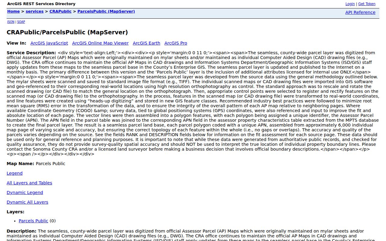
GIS exposes a rich record schema without turning the map into a household list. Fields can include APN, assessment number and status, full situs components, city type, sphere of influence, urban growth boundary, supervisor district, coordinates, current and prior sale documents and dates, sale prices, transfer types, use and tax codes, assessed values, exemptions, acreage, building size, rooms, year built, and update timestamps. Owner name and owner mailing address are absent from the public Internet layer when privacy conditions apply.
Geometry is generalized and variable in accuracy. It is useful for finding adjacent parcels and record links, not for a survey or a legal-boundary opinion. The service notes a query limit of 2,000 records. For richer extracts or availability questions, the county research identifies 707-565-1888 as the GIS contact.
Note: The public parcel layer is a record map, not a survey, and its owner-name omission is an intentional privacy limit.
Rohnert Park Street Records by Address
Each address-keyed source answers a different part of a Rohnert Park street directory question. The APN ties a map polygon to county data. The legal description ties a deed to a parcel even when a street label changes. A permit shows work and dates. A voter file, if an approved request applies, shows registered residence fields rather than every occupant.
| Street source | Keeper | What it shows | Access |
|---|---|---|---|
| Assessor property result | Sonoma County Assessor | APN, situs, assessment, and characteristics | Free address or APN search; owner inquiry separately |
| Public GIS parcel | County GIS and CRA | Parcel shape, situs, sale, value, and building fields | Free interactive layer or query service |
| Recorded deed | County Recorder | Grantor, grantee, legal description, and recording sequence | Online index; office image or copy request |
| City permit | Rohnert Park Building Division | Address, APN, work, status, dates, and linked activity | eTRAKiT from January 5, 2001; older counter files |
| Approved voter file | Sonoma Registrar of Voters | Registered residence and election fields | Qualified purpose and application; protected records excluded |
| Historical directory or newspaper | Sonoma County Library | Dated names, addresses, notices, and household context | Digital collection, branch, microfilm, or staff request |
Access is not limited to a web form. The Recorder supplies office images and mail, email, or fax copy channels. Building Division records before the online cutoff are inspected at City Hall subject to availability. The library provides microfilm, catalog and finding-aid help. A focused request should identify a street, APN, date span, and desired record rather than ask for an undefined list.
Situs and Mailing Names in Rohnert Park
A situs address tells where the parcel sits. An assessed mailing address tells where a tax bill or other correspondence is sent. The two can differ because of a trust, business manager, an absentee owner, or a chosen mailing destination. A different mailing address does not prove where a person lives. A homeowners exemption can support an owner-occupancy inference, but its absence does not prove the opposite.
Four terms keep a Rohnert Park street directory search precise:
- Parcel
- A mapped assessment unit identified by an APN; it is a record key, not a household.
- Situs address
- The physical location assigned to the parcel for mapping and property records.
- Plat
- A recorded subdivision or lot map that helps bridge legal descriptions and changing street labels.
- Criss-cross directory
- A historical address-order section that may list an occupant or telephone entry for the publication years actually held.
Keep the APN, situs, mailing destination, legal description, and record date in separate fields. That simple separation prevents a tax mailing clue from becoming an unsupported claim about current occupancy.
Rohnert Park Deed Chains by Street
Start the deed trail with a current acquisition document or sale reference. Search the buyer as grantee, read the seller as grantor, then search that seller as a grantee in an earlier date range. The Recorder index accepts party names and can be narrowed by document type, recording date, document number, or book and page. Search every spelling variation because the index is a pointer, not a full-text address directory.
January 1964 divides the computerized index and image system from the handwritten books. For documents dated January 1964 forward, follow the current instrument number and image route. Before January 1964, browse the handwritten grantor and grantee index images, then retrieve the deed book and page. Sonoma County records predate 1850, but old instruments may use Rancho Cotate, Cotati, Penngrove, Santa Rosa Township, or a rural legal description instead of a Rohnert Park street name.
Recorded instruments can include grantors and grantees, a legal description, documentary transfer-tax information, return and tax-statement mailing destinations, signatures, a Preliminary Change of Ownership Report, and APN. The mailing destination can locate a correspondence trail after a sale, but it is not a residence proof. Use the Sonoma County Recorder services page and its self-service gateway, then use the copy desk for a specified instrument.
Rohnert Park Permit History Since 2001
The city says online permit information begins January 5, 2001, as explained in its additional building-permit information and online permit services. The Rohnert Park eTRAKiT search can use permit number, site address, parcel number, and other indexed choices. It can expose application status, plan-review comments, inspection notes, linked activities, and dates. Account creation is needed for applications, while a search is available for public record review.
The eTRAKiT property and map screenshot is a practical address-to-record entry point.
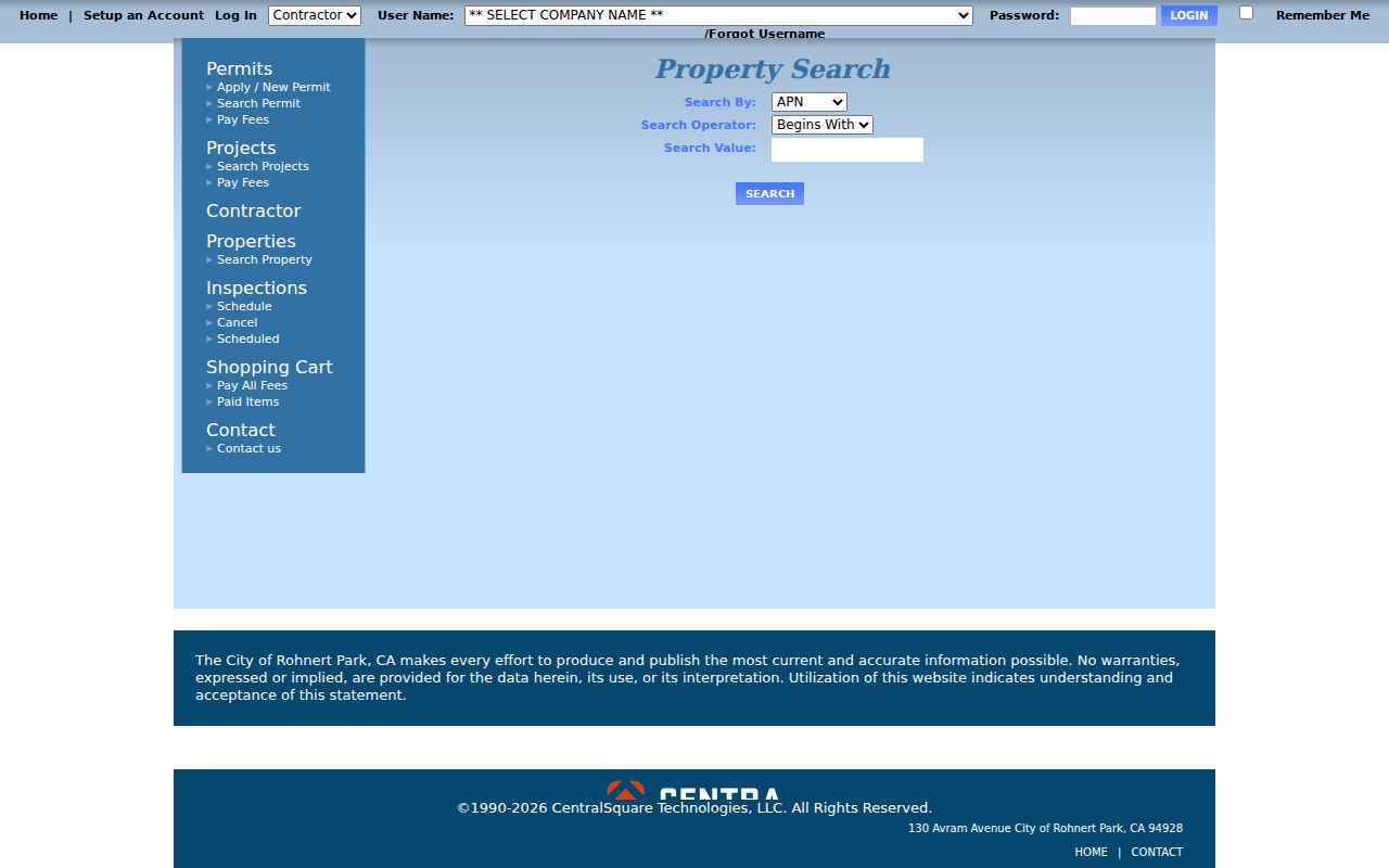
A verified permit result can display Permit Number, Type, Subtype, Short Description, Status, Applied, Approved, Issued, Finaled and Expiration dates, linked activities or subpermits, address, city, state, ZIP, property type, APN, subdivision, census tract and block, lot, section, township and range, acreage, attachments, and web links. Personal contacts and protected plans may be redacted. Older files go to the Building Division at 130 Avram Avenue, 707-588-2226, and are subject to availability due to ongoing records maintenance.
For county-jurisdiction permits, Accela also accepts city, ZIP, street number, direction, street name, street type, unit, parcel number, record type, date range, license type, state license number, or business name. Blank the start date to expand beyond its default recent window, then narrow by street or record type.
Note: Online permit coverage starts in 2001, so an older address trail needs the Building Division archive and availability check.
Rohnert Park Voter Search Limits
My Voter Status cannot browse a Rohnert Park street. It requires first and last name, date of birth, and a California driver license or ID number or the last four Social Security digits. Its output is the authenticated requester's registration, address, party preference, precinct, district, election information, and participation history. It does not list every registered person on a block and does not include every adult or occupant.
Elections Code section 2194 and 2 CCR sections 19001-19013 restrict voter data to election, scholarly, journalistic, political, or governmental purposes. An approved file requester must identify the organization, geography, intended use, users, recipients, delivery, and certification. Confidential voters and Safe at Home participants are excluded or protected. A city records request cannot replace the required elections application. Use the California voter status service only for the identity-gated task it was built to perform.
Before Rohnert Park, Search Cotati
Rohnert Park incorporated in 1962 after master planning in 1954 and first houses in 1957. An address that looks modern can therefore have an older record trail under Cotati, Rancho Cotate, Penngrove, Santa Rosa Township, or unincorporated Sonoma County. Change the place term as the record moves back. A legal description, subdivision plat, APN ancestry, or annexation file is a better bridge than assuming the present street label always existed.
The planned neighborhood pattern grew from a 2,700-acre seed-farm tract and early units of roughly 200-250 homes around a school and park. Lettered sections such as A, B, C, D, E, F, G, H, J, K, M, R, S, and W are map keys, not published household rosters. Growth east of Snyder Lane and west of Highway 101 also changed which planning or county record might hold an address.
Check the newest General Plan and the city or county map before calling a parcel part of Rohnert Park. Mailing ZIP and municipal jurisdiction answer different questions.
Note: A present street label can hide an older Cotati or Rancho Cotate record, so place-name changes belong in the search log.
Rohnert Park Reverse Directories
A true reverse or criss-cross directory is ordered by street and house number, then points to a listed occupant or telephone entry for a particular publication year. Sonoma County's official digital directory collection reaches from the 1870s into the early 1950s. The Petaluma, Cotati and Penngrove A-to-Z Directory for 1954-55 is the immediate predevelopment bridge. No authoritative itemized post-1955 Rohnert Park criss-cross run was located.
Fill that gap with local newspapers, telephone volumes if the library catalog identifies one, permits, deeds, voter materials available through the lawful channel, and census schedules. The Rohnert Park city directory collections page holds the publication years and entry-reading method. A missing directory year is a gap in the shelf, not proof that a person was absent.
Rohnert Park Annexation and Boundaries
When a street record changes custodian, look for a boundary reason. Sonoma County Archives holds an “Annexation City of Rohnert Park, 1968-1970” file in box 20249, collection SCG.00038.BDSU-0280.0650. An annexation or subdivision record can explain why a permit, tax, election, planning, or court reference uses a different jurisdiction while the physical location remains the same.
County GIS can relate a parcel to the city, sphere of influence, urban growth boundary, supervisor district, and other geography fields. ZIP 94928 extends beyond the municipal line, and Sonoma State's Rohnert Park mailing address lies outside the city sphere of influence. Verify the parcel and boundary before treating a street result as a city result.
For a public-record request, name the address, APN, map, time span, and record series. The City Clerk's request route allows inspection, electronic delivery, and paper copies when an existing record can be located.
Where the Rohnert Park Street Directory Stops
A Rohnert Park street directory cannot show every person connected to an address. People who are not parties to a deed, not named in a permit, not registered through an approved voter channel, or not printed in a dated directory may not appear. DMV and utility address data is restricted. Protected voter and Safe at Home addresses are intentionally withheld. An absent name is not a finding about residence.
Lawful use. Address and parcel records support personal, lawful research, family history, civic questions, and property curiosity. Do not use a Rohnert Park street directory to stalk, harass, intimidate, impersonate, or harm anyone.
Use the source custodian for a correction or a defined copy request. The county parcel service warns that owner name may be removed from the Internet layer, and the Assessor does not create contiguous-parcel data. Those limits are part of an accurate result, not a reason to fill the gap with guesswork.
Note: A missing name in a parcel, voter, permit, or directory result is not proof that no person lived at the address.