
Rohnert Park ZIP Code Coverage
Only one Rohnert Park street-delivery ZIP is verified in the local research. The postal number is used by City Hall, Sonoma State University, the library and archives, and official city facilities, but the postal area is not a legal outline of the city. A complete Rohnert Park ZIP code directory therefore has one confirmed row and a clear warning about what remains unverified. No authoritative source confirmed a second city ZIP, a ZIP split, or a realignment year. Do not add a nearby or PO-box number merely to make the table look fuller.
| ZIP Code | Areas Covered | Post Office or Verification | Notes |
|---|---|---|---|
| 94928 | Rohnert Park street-delivery addresses, civic facilities, library and archive addresses, and the Sonoma State postal address | Verify each complete address with USPS ZIP Lookup; a local station name and hours were not verified | Confirmed local ZIP; postal city and ZIP extend beyond the municipal jurisdiction |
That single-row result is useful. It tells a searcher to validate the address first, then use the city, street, APN, or permit fields that fit the record. A ZIP code directory should not imply a resident roster when the underlying source is a delivery system. It also should not state that every address with a Rohnert Park mailing city sits inside Rohnert Park.
Verify a Rohnert Park ZIP Code
The USPS ZIP Code Lookup is the first check for a complete street address. It can verify a ZIP from the address, city, and state, or find ZIP information from a city and state search. USPS answers the delivery question. It does not identify residents, decide whether a parcel is inside the Rohnert Park city line, or replace a county parcel search.
| USPS lookup input | Use | What the result means |
|---|---|---|
| Complete street address | Check a known location | Returns the postal ZIP tied to that delivery address. |
| City and state | Explore postal coverage | Shows available ZIP choices without proving a city boundary. |
| Address spelling and unit detail | Resolve a near match | Helps distinguish a deliverable address from a rough place label. |
The USPS screen at the manifest source provides the verification route used by a ZIP code directory search. Run the postal check before filtering permits or comparing a parcel with a city map.
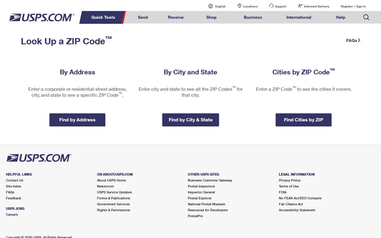
A returned 94928 result is a postal fact. The next step is to test the same address against a parcel or jurisdiction layer, because postal city wording can remain stable while municipal boundaries change.
Rohnert Park ZIP Code Boundary
Sonoma State University uses a Rohnert Park, California 94928 mailing address at 1801 East Cotati Avenue, yet the Rohnert Park General Plan places the campus outside the city's sphere of influence. The example makes the local boundary issue plain: a ZIP code and postal city can identify how mail is routed without proving that the address is inside the city or its planning jurisdiction.
The address-searchable Rohnert Park district map adds a civic geography check. It can place an address in a council district and show surrounding districts, but it is not a resident directory. County GIS and permit systems may cover nearby unincorporated land even when a mailing line looks like Rohnert Park. Keep the postal result, city map, parcel layer, and agency jurisdiction as separate fields.
The city map source shows why a ZIP code directory should be paired with a boundary question. A council district, sphere of influence, and urban growth boundary are different overlays, and none should be inferred from a mailing label alone.
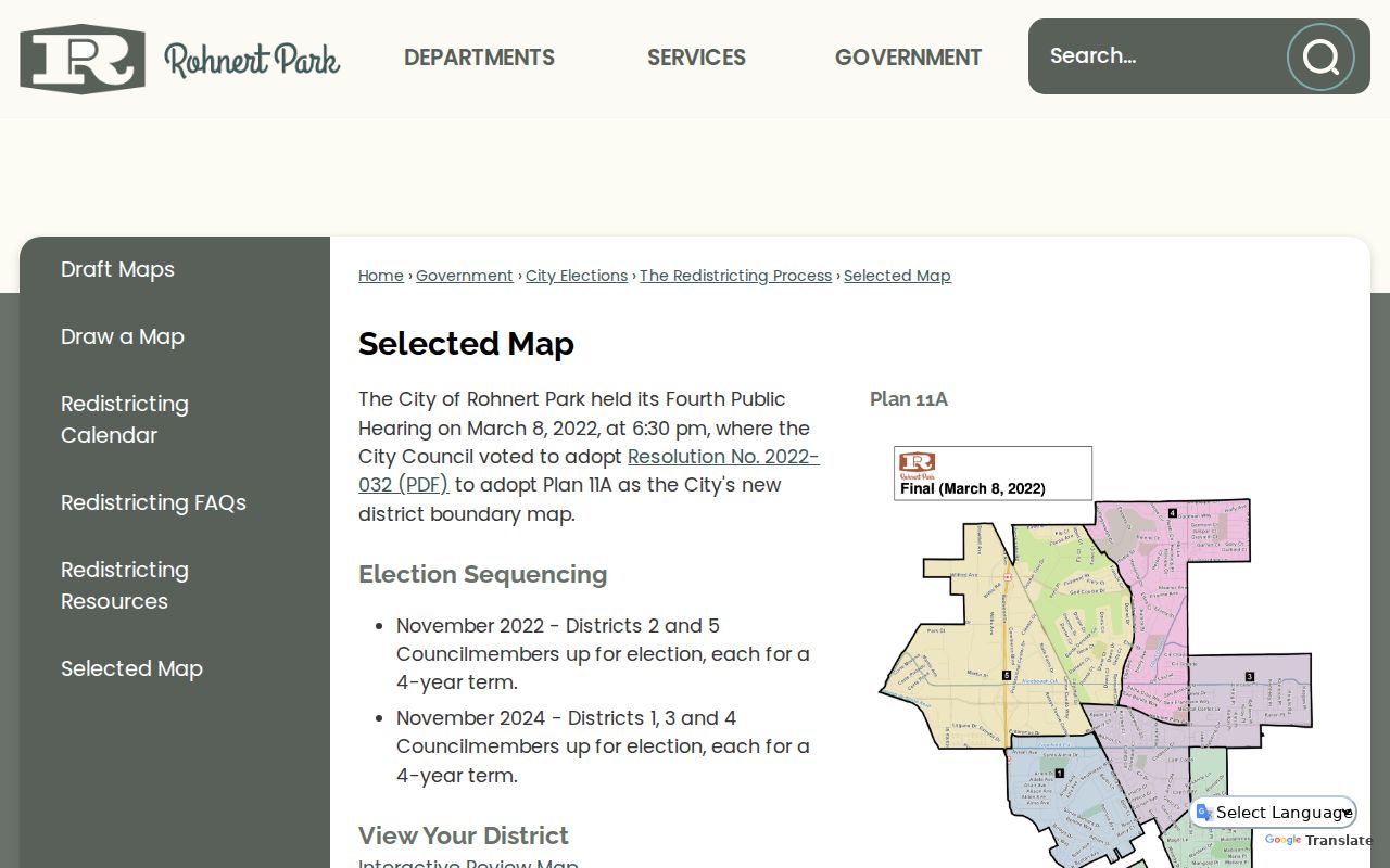
For a resident or property question, use the ZIP only as the first geographic filter. The parcel's situs and APN decide which county or city record system should receive the next search.
Rohnert Park ZIP and Parcel Terms
A ZIP code directory becomes more accurate when each address term stays in its lane. Postal geography describes delivery. Parcel geography describes land. A legal description can survive a street renaming or postal change, while an APN is an assessment and index key rather than the legal description itself.
- ZIP code
- A USPS delivery-area code used to route mail. It is not a city boundary or a list of residents.
- ZIP+4
- An added four-digit delivery refinement used by USPS for a more precise route or segment.
- Situs address
- The physical location of a parcel, used by the assessor, GIS, and permit systems.
- Owner mailing address
- The destination for tax or owner correspondence. It can differ from the situs and does not prove occupancy.
- APN
- The assessor's parcel number, used to index property evidence. It is not itself a legal description.
- ZCTA
- A Census statistical approximation of ZIP geography. It supports analysis but is not an official USPS boundary.
These terms matter when a ZIP result is compared with a property roll. A mailing address may point to a different city, a situs may sit outside the city sphere, and a legal description may lead to the same land after the street label changes.
Rohnert Park Permit Search by ZIP
Sonoma County Accela is the clearest researched permit route that accepts a ZIP field beside city, street, and parcel inputs. A ZIP-wide query can be broad, so narrow it by record type, date, street, or parcel after the first pass. The default date view covers the last three years; leaving the start date blank expands the search beyond that default. Saved or application functions can need an account, while basic searching is free.
| County Accela field | Format or use |
|---|---|
| Search All Departments | Checkbox for a wider department search. |
| Record Type or Number | Limit the result to a known permit class or identifier. |
| Start Date and End Date | Use a date range; blank start expands beyond the default recent period. |
| Project Name | Search a named project when one is known. |
| License type, state license number, or business name | Connect a permit to a licensed or named applicant. |
| Street number, direction, name, type, and unit | Build a street query, with separate address components. |
| City, State, and ZIP | Use 94928 as a postal filter, then compare the address to jurisdiction. |
| Parcel number | Use the county xxx-xxx-xxx format when an APN is known. |
| Search and Clear | Run or reset the query. |
A permit applicant, contractor, or project contact is not automatically a resident. Keep the ZIP result tied to the permit number, address, APN, and status dates. If the county system is too broad, use the city eTRAKiT system for Rohnert Park permits and check its separate coverage rule.
Find Rohnert Park Residents by ZIP
A ZIP code directory search is a narrowing workflow, not a single public name search. The assessor portal does not offer ZIP as a search mode; its choices are fee parcel, assessment, or street address. My Voter Status does not provide a public ZIP browse. County GIS can relate parcels to boundary layers, but the public parcel service is keyed to APN and situs data. Use the ZIP to reduce the geographic scope, then switch to the record that actually contains a name or address clue.
- Verify the complete street address with USPS and save the returned ZIP with the search date.
- Check county or city permit results using 94928, then narrow by address, date, record type, or APN.
- Use the county parcel service or assessor address mode to identify the situs and APN; do not assume the Internet layer shows the owner name.
- Use a court, vital, license, business, or library index only when its record type fits the person question.
- Once the ZIP narrows to a street, move to the Rohnert Park street directory for address-keyed parcel and permit work.
The result should say what the ZIP confirms and what it does not. It can support a postal match or a permit filter. It cannot prove that every person connected to the address lives there, and it cannot open protected voter, utility, delivery, or DMV data.
Rohnert Park ZIP Geography Sections
Rohnert Park's local geography is more detailed than one ZIP code. Official mapping uses lettered sections including A, B, C, D, E, F, G, H, J, K, M, R, S, and W. Those labels help a researcher compare a parcel, council district, school, park, or neighborhood map. They are not ZIP subdivisions, postal routes, HOA rosters, or proof that a named household belongs to a section.
The planned neighborhood pattern also explains why a ZIP-wide result can hide useful local context. Initial units were designed around a school and park, with roughly 200 to 250 homes in a unit. A lettered section can be a better map key for a civic question, while a street address and APN remain the better keys for a property question.
Use the section name as a geographic clue only. If a map search returns a nearby section, confirm the parcel, street, and city jurisdiction before treating it as a Rohnert Park record.
Rohnert Park ZIP Growth Context
Rohnert Park's growth history sits behind the current postal map. A 1954 neighborhood plan preceded infrastructure and first houses in 1957, followed by incorporation in 1962. Growth reached Snyder Lane by 1980. G Section developed east of Snyder, and areas west of Highway 101 expanded in the 1980s. Later planning references include University District, SOMO Village, Canon Manor, and Southeast, Northeast, Northwest, and Wilfred-Dowdell specific-plan areas.
Older records may use Rancho Cotate, Cotati, Penngrove, Santa Rosa Township, or unincorporated Sonoma County rather than the modern city name. That change affects newspapers, directories, deeds, permits, and historical census geography. A ZIP code directory search for a current address cannot be pushed backward in time without changing the place terms and record custodians.
Growth geography also explains the Sonoma State example. A large institution can share the postal route while following a separate planning and jurisdiction history. Treat the ZIP as a delivery bridge, not as a complete local boundary.
Rohnert Park ZCTA and ZIP Statistics
Census ZCTAs approximate ZIP areas for statistical reporting. They are built for analysis, not for USPS delivery decisions or parcel-level jurisdiction. A ZCTA can smooth or reshape the actual delivery area, especially near a city edge, a highway, an institutional campus, or unincorporated land. A population or demographic figure tied to a ZCTA should not be presented as a count of Rohnert Park residents.
For statistics, label the geography exactly as the source does. For a person or parcel, return to the complete street address, USPS result, situs, APN, and agency boundary. The distinction prevents a ZIP code directory from turning an approximate statistical shape into an exact city map.
Rohnert Park ZIP Evidence Gap
The research did not verify a second ZIP serving the city, a PO-box-only 94927, or a ZIP split or realignment year. That is an evidence limit, not proof that postal systems can never change. Check a complete address with USPS when a new development, unit, campus building, or mailing instruction suggests a different route. Do not publish 94927 as a Rohnert Park ZIP without a USPS result.
The same caution applies to post-office names and hours. No local station name or hours were confirmed in the source set, so the reliable action is address verification rather than an invented station detail. A current ZIP code directory should keep the confirmed 94928 row, state the gap, and send parcel questions to the appropriate county or city custodian.
Note: A ZIP result can narrow a search, but only a record custodian can confirm the meaning of a person, parcel, permit, or legal filing.